Scotland hour-by-hour forecast: Here’s when 80mph winds will hit the country after weather warnings
This weather warning is in place from 9pm on Monday (3 Feb) to 7am Tuesday (4 Feb), covering southwest Scotland, the Lothians, the Borders, Dumfries and Galloway, and Strathclyde.
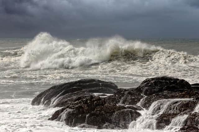
The Met Office said, “A spell of very strong winds will affect western Scotland during Monday night and into Tuesday morning. Gusts of 65 mph are likely, with the potential for 70-80 mph gusts in a few of the more exposed places in the Western Isles.
Advertisement
Hide AdAdvertisement
Hide Ad“The swathe of stronger winds will move southwards overnight, with winds then easing from the north.”

Hour-by-hour-forecast
21:00 - Light shower - wind gusts of 50mph
22:00 - Heavy rain - wind gusts of 53mph
23:00 - Heavy rain - wind gusts of 54mph

00:00 - Light rain - wind gusts of 55mph
01:00 - Light rain - wind gusts of 56mph
02:00 - Heavy rain - wind gusts of 57mph
03:00 - Heavy rain - wind gusts of 56mph
04:00 - Light shower - wind gusts of 49mph
05:00 - Heavy rain - wind gusts of 49mph
06:00 - Light shower - wind gusts of 43mph
07:00 - Light shower - wind gusts of 37mph
What to expect from this weather warning:
- There is a small chance of injuries and danger to life from flying debris
- There is a slight chance of some damage to buildings, such as tiles blown from roofs
- There is a small chance of longer journey times or cancellations as road, rail, air and ferry services are affected
- There is a small chance that some roads and bridges could close
- There is a slight chance that power cuts may occur, with the potential to affect other services, such as mobile phone coverage
- There is a small chance that injuries and danger to life could occur from large waves and beach material being thrown onto sea fronts, coastal roads and properties
This week’s forecast
The UK on Tuesday (4 Feb) is set to be windy with showers in the morning, but turning mostly dry with sunny spells through the afternoon in the north and west.
Advertisement
Hide AdAdvertisement
Hide AdThe outlook for Wednesday to Friday forecasts that it will be mostly dry with sunny spells and overnight frost and fog.
It will be cloudier in the northwest, with perhaps some light rain and drizzle at times.
Long-range forecast
Looking further ahead, the UK outlook for Friday 7 to Sunday 16 Feb explains that, “Further ahead, unsettled conditions are expected to dominate. Although there will be spells of rain and strong winds at times, these will be interspersed with brighter but showery interludes.
The heaviest rain or stronger winds are expected in the west and northwest with the best of drier and brighter conditions in the south and southeast.
“Any colder interludes carry the risk of frost or wintry showers on high ground in the north, however these are expected to be short-lived.”